The Sacred Valley: Ruins, Rivers, and a Kid Who Knew More About California Than I Did (3/6)
The Incas mirrored the Milky Way in a valley. Then they built things on top of it that still defy explanation.
Part 3 of the Peru series · Updated for Travel with Sheridan
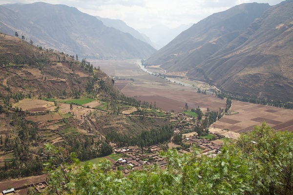
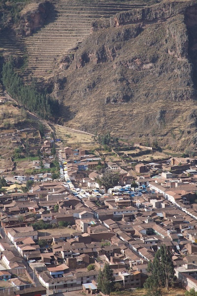
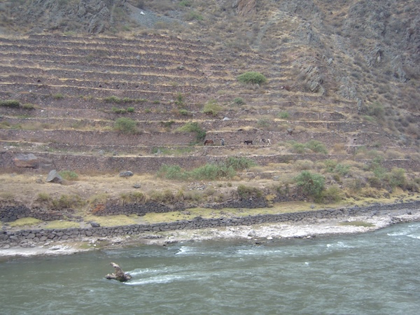
The Sacred Valley of the Incas runs between Cusco and Machu Picchu, following the Urubamba River through some of the most dramatic mountain scenery in South America. The Incas considered it sacred partly because of its exceptional agricultural conditions and partly because they determined, through careful astronomical observation, that it mirrors the path of the Milky Way. One end of the valley aligns with the ruins at Ollantaytambo. The other with Pisac. The two sites mirror constellations. The Incas were deeply, almost obsessively into astronomy, and the more you learn about them the more that becomes one of the least surprising things about them.
We boarded a bus from Cusco for a full day in the valley with a guide who loved his country with infectious enthusiasm. His particular joy was saying "Urubamba" with a long, rolling trilled R and heavy emphasis on the "bamba." He said it often. We appreciated it every time.
 Back to Pisac, Briefly
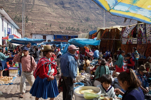
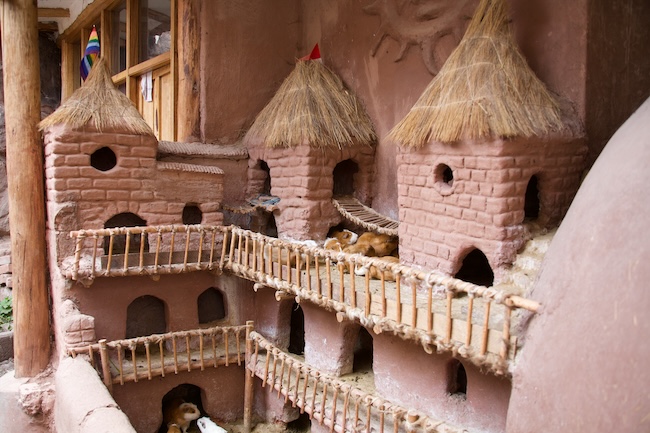
Our first stop was Pisac again, though this time it was a quick pass through the market rather than a full lunch stop. Our guide knew exactly where to find the best empanadas, so we followed him there without question. He also pointed out the guinea pig display, which operates essentially like a lobster tank at a seafood restaurant: the animals are kept live until needed. It is a perfectly logical system that we found both charming and mildly alarming.
We did some shopping, took some photos, and got back to the bus. Two members of our group did not get back to the bus, and our poor guide spent a good half hour running circuits through the market trying to locate them. We eventually gave up waiting and headed out. Group travel has its moments.
Lunch on the River
Lunch was a buffet at a lovely restaurant right on the Urubamba River, surrounded by mountains and other tour groups doing exactly what we were doing. We ended up sharing a table with travelers from Sweden who had come to Peru for a family wedding in Arequipa. It was one of those easy, random conversations that only happen when you are eating in a strange country and have no particular agenda. The food was excellent.
Ollantaytambo
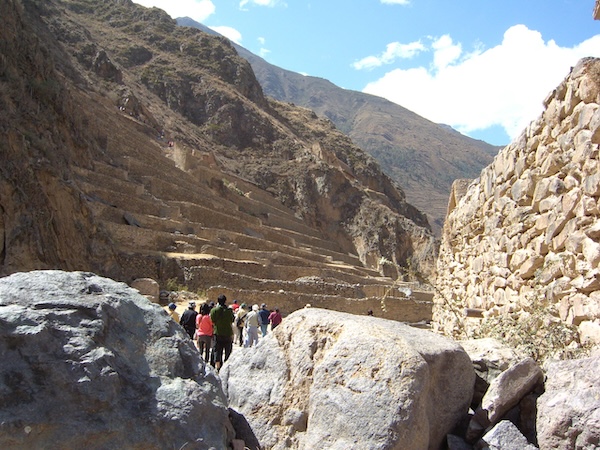
I cannot reliably pronounce Ollantaytambo. I have made peace with this. What I can tell you is that it is one of the most impressive places I have ever stood, and I think about it more than is probably normal for a pile of rocks.
The name comes from Ollantay, a favored general under Manco Inca who used this site as a fortress to resist the Spanish conquest. "Tambo" means fortress, so this was quite literally the fortress of Ollantay. It is also the only town in Peru that has been continuously inhabited since Inca times. Many of the buildings in the town below are still the original Inca construction, still in use, which is extraordinary when you actually stop to think about it.
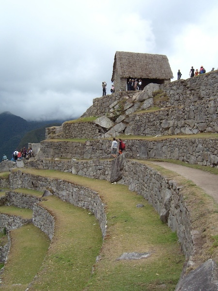
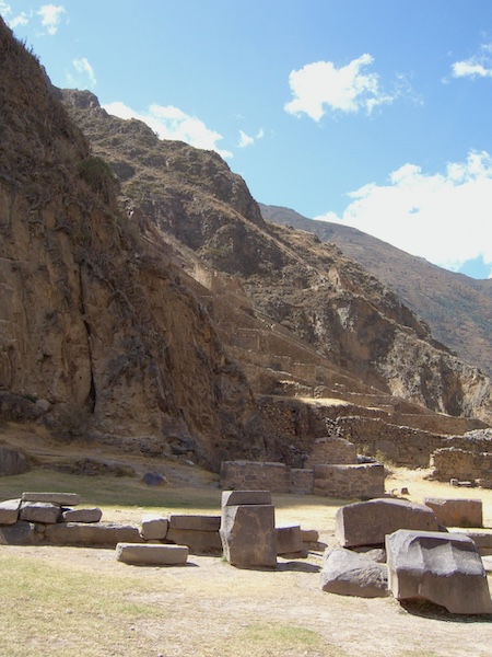
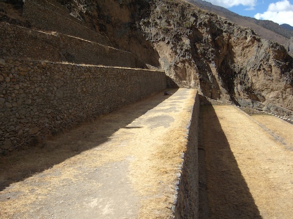
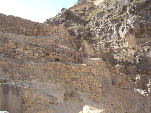
The ruins themselves lord over the town from a steep hillside. The terraces are enormous. The stones that form the walls at the top are even more enormous. They were hauled here from a quarry across the valley and up the mountain without wheels, without iron tools, and without any technology we would recognize, and they fit together so precisely that you cannot slide a piece of paper between them. No mortar. Just masonry so perfect it has lasted through centuries of Andean earthquakes.
At the base of the terraces there is a temple area with water channels that still run. From there you climb 200 steps to reach the upper section. The view from the top across the valley and the town below is worth every single one of those steps, even at altitude. Especially at altitude, honestly, because earning it makes it better.
On visiting Ollantaytambo: Wear layers and bring water. The climb is not technically difficult but the altitude makes it feel more demanding than it looks. Take your time going up. The ruins are included in the Boleto Turístico, the regional tourist ticket that covers most of the major sites around Cusco and the valley. Verify current pricing and what is included before your trip, as these details change.
 Chinchero
After Ollantaytambo, we drove up through the mountains and descended into the small village of Chinchero. Women had their weavings and crafts spread out in the Plaza de Armas, and kids worked the crowd with paintings, necklaces, and the obligatory traditional costumes.
One of them approached me with watercolors and asked where I was from. I told him Colorado. He immediately rattled off more California facts than I could verify, then pivoted to Colorado and Texas with confidence. He admitted he could not remember the current Texas governor. I told him I could not either, so we were even. I bought one of his paintings of the village. He was an art student in Cusco. He earned that sale.
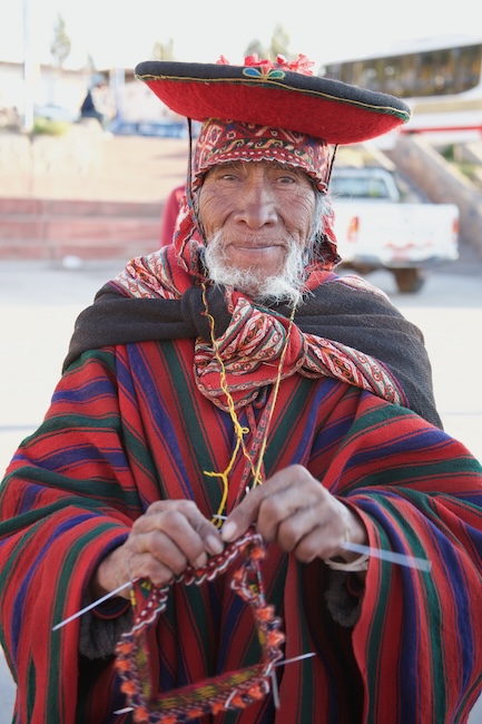
On the way out of town, I noticed an older man on the hillside in gorgeous traditional garb with the kind of weathered, craggy face that makes a photographer want to be sneaky about it. I took a few shots from a distance, thought I was being subtle, and was immediately busted. He followed me down the hill. I paid him, he posed properly, and it turned out he was knitting a hat the whole time. Some of my favorite photos from the whole trip came from that five minutes.
On photographing people: In markets and villages throughout the Sacred Valley, many locals in traditional dress will pose for photos in exchange for a few soles. It is a common and accepted arrangement. Ask first, pay fairly, and do not try to sneak shots of people who have not agreed. The man on the hillside in Chinchero made that point more gracefully than I deserved.
We made our way back to Cusco as the light was fading, packed our bags, and prepared for the early train to Aguas Calientes. Machu Picchu was next, and no amount of photos had prepared us for what we were about to see.